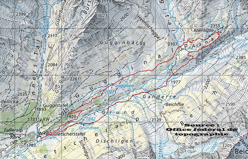
Anenhütte
12km
Minimum altitude: 1,776 m
Maximum altitude: 2,351 m
Difficulty level: T2
Approximate walking time: 4h00
Ascent: 619m
Descent: 625m
To get there:Motorway A9 to Sierre. Then cantonal road to Gampel and direction Lötschental. Follow the main road down the valley to Fafleralp via Ferden, Kippel, Wiler, Blatten.
Where to park:Nothing could be simpler. Indeed, a large paying car park awaits you at Fafleralp at the bottom of the valley. Price: CHF 7.- / day
The hike starts at the east end of the parking lot. A mountain road will take you to the bridge over the Lonza. At this point, you can choose to take the path that runs along the right bank or the one that runs along the left bank. We chose the first option. The path, winding through blueberries, pines and junipers, first led us to the hamlet of Guggistafel and the lake of the same name (Guggisee) where we stopped. Continuing towards the Anenhütte, you will have a magnificent view of the Breithorn and the Jegichnubel. Only the ascent from the Anunbach bridge to the hut requires a little more effort, otherwise the ascent is gradual.
The modern hut dates from 2008 and is the only private and independent hut in the Swiss Alps.
To descend, we took the path that runs along the left bank of the Lonza River. This one starts at the bottom of the stairs leading to the cabin's terrace. Turning to the left, you can observe the trace of the former limit of the Lang glacier (Langglestscher). The descent requires good shoes and walking sticks can help you!


© 2019 by Swisstreks. Any reproduction or distribution is prohibited without the authorization of the author.