Minimum altitude: 1,378 m
Maximum altitude: 2,057 m
Elevation +: 746 m
Approximate walking time: 3h50
Difficulty level: T2 / T3
To get there:
From Lausanne, motorway A9 to Vevey, then A12 to Bulle and thentowards Château d'Oex, Gstaad finally towards Lauenen.
From Fribourg, motorway A12 towards Bulle and then towards Château d'Oex, Gstaad and finally towards Lauenen.
Parking: Paid parking spaces near the lake. (around CHF 10.- for the duration of the hike, i.e. around 5 hours with breaks).
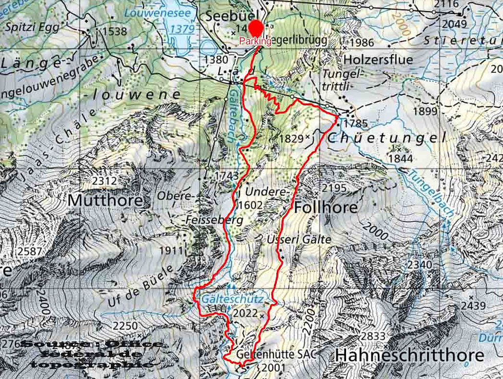
Route that will take you to the Geltenhütte at a little over 2,000 m above sea level in the valley traversed by the Gältebach on the side of the place called "Walki". This valley will allow you to observe several waterfalls and a very beautiful flora.
The route of the loop we suggest starts at the Lauenensee car park and takes you up along the Gälte, to then flirt with its tributaries (this will be the steepest part of the route) and then cross it a second time, before reaching the hut. The return is on a path which requires a sure step but it is equipped with a rope to secure certain somewhat steep passages.
Note that it is interesting to walk beyond the hut. Indeed, you can continue your hike to the entrance to the valley "or rather the Rottal cirque (photo 03) and come back to the hut by making a small loop. Allow 30 additional minutes to make this small loop of approximately 1.5 Km and a drop of more than 125 m all the same!
Data provided by Isabelle Aebischer Hertling and her husband


© 2019 by Swisstreks. Any reproduction or distribution is prohibited without the authorization of the author.